


March 25 – April 30, 2019: After another incredibly easy time of dealing with customs and immigrations to clear out of Malaysia, we cast off bright and early on March 26 from Miri Marina. Destination: Anambas, Indonesia.
With three days and 350 nautical miles to cover until our first stop, we did rotating one hour shifts at the helm during the day, switching to three hour shifts from 1800 hours to 0600 hours. Seas started calm, but it wasn’t all smooth going. Twice, Sandra ran to the rails and vomited overboard after spending time below decks preparing meals. Lightning lit up the night sky from time to time, and we spent a lot of time handsteering due to some faults in the autopilot compass. (At one point, Sandra did a complete 180 after an unexpected dodge. A dodge happens when an autopilot button sticks in a continuous turn, rather than turning one degree per click. Wouldn’t you know it, Chris picked that exact moment to wake up and point out her error before she had a chance to self correct.) We passed offshore oil platforms, service vessels and fleets of boats fishing with nets, but didn’t see any other cruising yachts the entire way. Kitty was unimpressed by all this passagemaking rigmarole, despite the kamikaze fish that landed on board each night, although he did eventually make a few forays outside his basket to eat, use his litter box and lounge about the pilothouse and the cockpit. There were occasional rain squalls and bursts, so at least it wasn’t too hot.
Boy were we chuffed when we spotted Natuna veiled by heavy clouds ahead. We anchored off a sand spit across from a small fishing village on the afternoon of our third day out. We had covered the 350 nautical miles in 55 hours, averaging 6.5 knots. Not too shabby.


The village’s new looking mosque made call to prayers every few hours, but it wasn’t overly loud, thankfully. It was an early night, fast asleep after dinner, a couple of celebratory beers and the final prayers of the evening.
Morning prayers came early, but we slept in anyway. After breakfast we had a visit from the Indonesian Navy. Well, from Rendra, anyway. Rendra is a local navy man without a navy boat. He had to get two of his fishing buddies to bring him out to greet us. After formalities, which comprised of taking photos of our passports and boat documents, Rendra shared information about where to get fuel and fresh water and invited us to a basketball game in town that evening.
The water was clear enough that we could make out the patchy sand and coral bottom 40 feet below us. How refreshing after the thick brown water along the Borneo coast, the result of all the rivers that deposit silt far offshore. Chris took advantage of the water clarity and cleaned our hull.
We never did make it in for the basketball game. We would have liked to spend more time exploring a few of the 272 islands (population just under 90,000) that makes up the Natuna Regency, but with no government services available to handle the administration of clearing in, we decided it was best to continue on to the Anambas islands, a further 107 nautical miles westward. We were underway by mid afternoon.


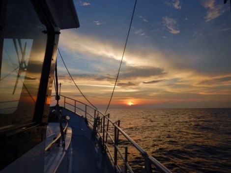
What a difference a day makes. This time, the sea was glossy with minimal swell. Finally, we had true trawler weather. To top it off, we had at least a dozen dolphins frolicking in our bow wake for a good ten minutes. No matter how often this happens, I can’t get enough of it. That night continued calm, with the stars reflecting on the water and incredible bioluminescence in our wake.
By morning, the Anambas islands were right in front of us. The Anambas Regency, with 255 islands (only 26 are inhabited) and a reported population of 45,000, is well off the beaten track, but I expect that will change fast. Tourism is just starting to pick up and it has become increasingly popular with yachties looking for that quintessential tropical island experience without a lot of unchecked development.
I’d say the number of photos we took is a pretty good indication of how much we liked the Anambas. 1,867 photos during the five weeks we spent in the islands. It’s a special place with incredible scenery, beautiful beaches, crystal clear water, healthy reefs and fish life, uncrowded anchorages and friendly people. Here are a few of the many highlights.


")

Moonrock Bay
What a way to start our Anambas adventures! After a night crossing, we had to carefully pick our way in to this stunning bay between Pulau Sagu Dampar and Pulau Sama through a tricky channel surrounded by shallow reefs and then find a sandy patch to set the anchor. Fortunately, we had good waypoints from our various cruising notes, but it was still nerve wracking to see the reefs so close on either side of us. We liked this anchorage so much, we spent three nights here, kayaking, beachcombing and climbing up to the bare granite outcropping that gives Moonrock Bay its name. Stellar views over the anchorage and the islands near and further afield.


Tarempah and Check-in
We figured we ought to head to the Anambas capital, Tarempah, and get our Indonesian clearance out of the way before they started to wonder what took us so long on the route from Miri. We wound around and between reefs and islands for 16 nautical miles to reach the harbour at Tarempah, situated on Pulau Siantan. Our charts were not terribly accurate, so Chris took the helm and Sandra spent a lot of time up on the pilothouse roof watching for shallow areas. In the harbour, there were four yellow moorings and all but the one closest to the ferry terminal were available. Tying up was a new challenge for us, as there was no trailing line to grab. Instead, we had to hook the ring on top, bring it to the stern, get a line through it, and walk it back up to the bow. There was no current, wind or speedboats roaring by at the time, so it was pretty straightforward.
Once we were settled, we donned our duds for dealing with officials. This means long pants, collared shirts and shoes, and it’s always uncomfortable in the heat. Our first stop was immigration. Even though we were the only ones there, this stop took more than an hour as they hunted for their stamp to chop our passports. Customs and quarantine were the next stops. At customs, the officer was wearing his uniform, but barefoot. At quarantine, the officer had the sniffles. Then it was back to customs to collect two officers and take them to Moken in our dinghy for an inspection. This was another new experience for us, but it was fairly straightforward. Chris showed them around. They asked what was in a few cupboards, took a few selfies with Nukaat and a few photos of the boat before we ran them back to shore. By this time, the harbour master’s office was closed for the day, so we still had one more stop to make the following morning.
Our next order of business was getting a SIM card, which sounds easier than it really is. It took a bit of creative problem solving, but we managed with the help of John, a local Indonesian, who purchased it for us under his name, thereby circumventing the restrictions on foreigners. We spent the rest of the evening on board, which should have been relaxing as the town settled down for the evening, but we couldn’t get away from the competing loudspeakers at the various mosques around town and the motorbikes buzzing by on the nearby causeway.
We spent three nights on the yellow mooring and saw only one other yacht during our stay, but plenty of inter-island ferries of all shapes and sizes, cargo ships, fishing vessels, runabouts and workboats. We explored the town on land and by dinghy around the bay, did some shopping at the vegetable market and the fish market, finished our check-in with the harbour master, found a spot on the waterfront to enjoy a cold Heineken, and discovered otak otak, which are spicy fish cakes and squid cakes that are wrapped in banana leaves and grilled over charcoal. Our new local favourite street food.


Waterfall Bay
It was only 7.2 nautical miles to our next anchorage at Waterfall Bay and we were lucky to have really good light for winding through the reefs. En route, we passed a sailboat heading in the opposite direction. What a novelty. We anchored for two nights in a large bay with a great view of the rather waterless, waterfall. I’m sure it’s much more spectacular in the rainy season. Nonetheless, we hiked up to check out the middle pools and the upper pools and take some photos, before exploring the bay by dinghy. We were invited by Daisy and Jawa in to their home. Jawa was contracted to help build a new Chinese-owned resort and they gave us a tour, although it was still early in the process. Their English and our Indonesian were both pretty sketchy, but we still managed to communicate more or less over tea and fresh cakes.


Pulau Pejaul and Pulau Temeruk (Sandspit Island)
The next day, we wound our way out through the reefs and crossed over to the eastern islands in the archipelago. Our first anchorage at Pulau Pejaul involved another tricky route in through shallow reefs but resulted in a spectacular overnight anchorage, great opportunities for kayaking, nice beaches to explore and a better than expected shallow reef dive.
When the wind came up making our anchorage less desirable, we moved to nearby Pulau Temeruk, also known as Sandspit Island, a mere 3.2 nautical miles away. Here, we kayaked ashore and walked the spit. It was hot, so we returned again late afternoon with a couple of beers to watch the sunset and build a bonfire on the beach. We disposed of our burnables and some beach debris. This was another of our favourite spots, so we spent another night here. Day two was repeat of day one. Swimming and kayaking. Another beach cleanup and bonfire.


Pulau Mandariau Darat (The Rocks)
One can only chill at a sandspit for so long before getting itchy feet and wanting to move on. This time, we headed northeast to the Mandariau island grouping and picked a sheltered anchorage on the northwest coast of Pulau Mandariau Darat. There was one A-frame fishing platform anchored nearby. This was a great spot for climbing the boulders on the beach, snorkeling, kayaking and watching the parade of A-frames being towed to the offshore fishing grounds in the evening and returning the next morning. We liked it so much, we spent two nights chilling here, and each morning we were pleasantly surprised to be offered free tuna from the returning fishermen. We even tried a dive. More on that in our next blog post.


Tarempah Again
After the morning parade of A-frames, we upped anchor and returned to Tarempah to restock our supplies. This time we were the only yacht in the harbour. We had only planned to spend two nights this time, but our friend Iain on Lifeliner arrived from Borneo just as we were getting ready to leave, so we decided to stay put for another couple of nights instead. We stocked up on cumi cumi (squid) at the fish market and discovered a street vendor making Puto Bambu, very similar to the Puto Bumbong we loved in the Philippines, and equally popular with the locals. The food at LaLuna Restaurant near the start of the causeway was excellent and I was even able to purchase some of their extra hot sambal for use on board.


Pulau Tenggiling
On our next leg away from Tarempah, we headed north up the passage between Pulau Mubur and Pulau Matak. We passed by the airport, rounded Pulau Langor and anchored near Pulau Tenggiling. Our first attempt wasn’t to our satisfaction so Chris moved us in closer to the reef to anchor on a sandy bench while I watched the anchor set while snorkeling nearby. The water was really clear, the reef was healthy and there was a lot of fish. We spent two nights here, did some swimming, snorkeling and diving, kayaking, beach cleanups and bonfires.


Pulau Piugus and Pulau Pidi
We cruised around the outside of Pulau Semut and checked out the anchorage on the east side, but it seemed too exposed to the winds from the east, so we continued on around Pulau Batugaram and picked an anchorage near Pulau Piugus and Pulau Pidi overlooking the stilted cabins at Piugus Island Resort. There were two large fishing villages across the bay but no cellular signal near us. The anchorage was very sheltered but hot, as not much breeze at all. We did some kayaking around Pulau Piugus and spotted a shovelnose ray in the shallows. The resort was welcoming, so we decided to have dinner there on our second night. It was a set menu and very good. Fried calamari with a dipping sauce including soy, chili, ginger and citrus. A big bowl of rice, chicken soup with vegetables, and a whole reef fish. Dinner wrapped up with a plate of watermelon.


Pulau Penjalin
Even though we didn’t have a recent weather forecast to work with, we decided to take our chances and head out to the Penjalin island group, the northeastern most islands in the Anambas. We watched our depth carefully as we picked our way through the pass between Penjalin Besar and Penjlin Kecil and anchored in the channel between Pulau Setuju and a small rocky islet. The water was clear and made for nice snorkeling around the reefs. We took the dinghy out and explored around a number of rocky islets, bay, reefs and beaches. We scouted for potential dive sites. We landed on some of the beaches and swam in the shallows. We loved the bouldery coastlines and craggy headlands with coconut palms growing from the strangest places. We did a couple of dives and saw reef sharks!


Tarempah and Check-out
It was time to head back to Tarempah again. We legged it out from Penjalin trying to beat the rain but still got caught in it. It made for poor visibility on the run to town. It rained off and on, sometimes torrentially, for the next couple of days. So we stayed put on our favourite mooring in Tarempah, only venturing in to town between downpours to restock our provisions of fruit and vegetables or grab a bite to eat. The little inner harbour, which had normally seemed quite clean, was now chock full of trash. We tried to arrange a speedboat to get to the turtle sanctuary at Pulau Durai, but the weather wasn’t very cooperative and the price was very high.
On our final morning in Tarempah, we checked out. We took our trash to shore and went to quarantine (fast and easy), immigration (big line up but reasonably quick), customs (in and out in 10 minutes) and finally the harbour master. Here we ran into a snag. After taking all our documentation, they didn’t want to give us harbour clearance unless we hired a shipping agent. Persistence paid off and they eventually issued the paperwork we required after paying IDR 33,000 in port fees (compared to IDR 633,000 for port fees and an agent). Afterwards we wondered if the fact that it was a Friday (the day off in most Muslim countries) was a factor.
We were now officially cleared out of Indonesia, but we still had a few stops to make in the western islands before making the jump to west Malaysia.


Pulau Linggai
We tried to anchor near Pulau Genting Unyut, which was a beautiful spot, but it was not well protected from the northeast swell. Instead, we tucked in between Pulau Linggai and Pulau Semisak out of the current and swell. It rained a bunch here and then as it got dark the wind and swell shifted and headed straight for us. It was a wet, rolly, uncomfortable night, and unseasonably cold. Neither of us got much sleep.
Pulau Jemaja, Tukan Bay
We skirted the north side of Pulau Telaga and made our way west towards Pulau Jemaja. There were three anchorages we could have tried. Our preference, Pulau Ayam (Chicken Island), was the most protected but it had shallow reefs to navigate and with the high overcast sky, we didn’t have good visuals on the reefs. Padang Melang seemed pretty exposed, so we opted for Tukan Bay, thinking it would provide a bit more protection and be quieter. Wrongo. A swell started into the bay from the north, leaving us bobbing and rolling, and the chainsaws started up on shore, but we were too tired to move. Another rolly night.


Pulau Jemaja – Padang Melang
Third time’s a charm. We moved the short distance to anchor off Padang Melang beach. There was a lot less swell than we were expecting. After going ashore, we met up with Gusdi who runs the Sail Anambas group on Facebook. We’d been corresponding with him for a couple of months already, so it was nice to meet face to face. He got us sorted with wifi and then had to dash. The little town set back off the beach was clean and so was the beach. We wandered around and tried the gong gong (little snails) at a couple of different restos. There was a real trick to getting the snails out from their shells with the supplied toothpicks. As we were heading back to the dinghy, we met Ade. He was originally from Jakarta and used to work for Holland America on cruises to Vancouver, Victoria and Alaska.


Pulau Jemaja – Letong
Ade joined us on Moken the following day for the 15 nautical mile trip around to Letong on the west side of Pulau Jemaja. We anchored near Pulau Tulai across from the ferry terminal. It made for a bit of a longer ride to Letong by dinghy, but it meant we didn’t have to navigate through the shallow reefs in front of the town or be too close to the two big mosques on shore.
Letong is the second largest town in the Anambas after Tarempah, but it was much smaller than I was expecting. Much of the town is built on stilts over the water, but sadly the water was filled with a lot of trash, including diapers everywhere. Because the town and the roads are built so high above the water, we had to scale the steep, rickety wooden ladders at the harbour to get ashore. We had an excellent seafood lunch at a warung at the harbour and wandered around the town, followed everywhere by a group of young boys on bicycles. They tried out their English. I tried out my Indonesian. They laughed.
We met up again with Gusdi at sunset at the Miranti Hotel on the waterfront to feed lettuce to the local turtles and again early the next morning for a trip to the markets in town. They were all very nice, newer open spaces, clean and painted green and white. One section sold fruit and vegetables. One sold seafood. And one sold local cakes and fried treats. There were no eggs to be found anywhere. They were all reserved. Gusdi was guiding a large group of tourism officials that day. They were in the Anambas to prepare a tourism inventory and master plan. I hope trash cleanup was high on their priority list.
After a complimentary lunch put on by the owners of the hotel, in celebration of their daughter passing the civil service exam, we took some last minute photos, said our goodbyes and headed back to Moken. We were underway, heading towards west Malaysia by mid afternoon, trying to get a jump on the looming rain clouds.
It was sad to leave the beautiful Anambas Islands behind, but we soon had to turn our attention ahead. There were wide, busy shipping lanes to cross and big weather systems showing up on our radar. With a lot more traffic than expected, cargo vessels and tankers heading in both directions, we aimed to cross behind each one. Once dark set in, we also had an endless array of fishing boats and squalls and lightning to deal with. It was a long night, but by dawn, we could see Tioman ahead of us.
The Anambas weren’t all beautiful beaches, spectacular diving and glorious sunsets. We had our share of challenges. The first being the sad state of our charts, and it wouldn’t be boating without a few mechanical issues. There were problems with our autopilot, a leak in our dinghy’s fuel line and our generator acted up. Worst of all was probably the amount of plastic we found floating in the water and washed up on every beach, much of it coming from offshore.
On the plus side, Chris was able to get our watermaker and our deck shower up and running. These certainly do make life on board much easier and more enjoyable…and make deck cleaning more fun too.
Our Anambas Cruising Resources and Anchorages
Before we left Borneo, we asked other cruisers for their favourite Anambas anchorages and cross referenced this against the following cruising notes we found online. Information about clearance and formalities can change from time to time, so it’s always best to get the most up-to-date information you can find, but at least the anchoring information stays fairly constant.
SY Alba: 2016 Anambas Islands Cruising Notes
Sail Malaysia Rally: 2018 Cruising Notes for Yachts
MV Solita: Anambas and Natuna Islands Anchorages
Our charts were none too detailed, so we didn’t always know the names of smaller islands where we anchored or the exact location of shallow reefs and rocks. We updated Navionics for our chartplotter while we were in Tarempah and that helped some, but we found the Malaysia rally cruising notes and corresponding OpenCPN coordinates, together with the community edits in the Navionics app and referencing Ovital Maps to be much better resources. Of course, eyes on the water from the roof of the pilothouse also helped, especially navigating around shallow reefs. (One year later, I’m seeing even more soundings, anchorages and onshore services added in Navionics community edits. Way to go yachties!)
For our cruising friends, these were our anchorages:
| Dates | Anchorage | Position | Notes |
| March 28, 2019 | Pulau Setahi, Natuna Regency | 3° 37.653’ N
108° 7.521’ E |
40 feet on sand with coral patches. Across the channel from a small fishing village. |
| March 30, 2019 | Moonrock Bay, Pulau Sagu Dampar / Pulau Sama | 3° 14.897’ N
106° 26.767’ E |
Highly recommended. Tricky entrance through coral reefs. Approach in good light. Private islands. Resort may not welcome yachties. |
| April 2 2019 | Tarempah Harbour, Pulau Siantan | 3° 13.175’ N
106° 13.152’ E |
Yellow moorings, no trailing lines. Tie dinghy to dock in the inner harbour near the ferry terminal. Immigration, quarantine, customs and harbour master are all located relatively close together. Good markets for fruit, veg and fish. |
| April 5, 2019 | Temburun Waterfall | 3° 10.667’ N
106° 16.778’ E |
Watch out for all the fish farms in the bay. Very protected. |
| April 7, 2019 | Pulau Pedjual | 3° 9.245’ N
106° 23.443’ E |
Worthwhile stop but watch carefully for shallow reefs on the way in. |
| April 8, 2019 | Sandspit Island, Pulau Temeruk | 3° 9.531’ N
106° 25.577’ E |
Great beach. Anchored in 30 feet. |
| April 10, 2019 | Pulau Mandiriau Darat | 3° 18.285’ N
106° 23.448’ E |
Beautiful area. 32 feet on sand. |
| April 12, 2019 | Tarempah Harbour | Per above | – |
| April 16, 2019 | Pulau Tenggiling | 3° 22.687’ N
106° 13.990 E |
Highly recommended. 15 feet on sand |
| April 18, 2019 | Pulau Piogus / Pulau Pidi | 3° 18.588’ N
106° 19.166’ E |
Anchored in 50 feet. Very sheltered. Meals available at the Pulau Piogus Resort with advance notice. |
| April 20, 2019 | Pulau Penjalin / Pulau Setuju | 3° 23.577’ N
106° 26.897’ E |
Highly recommended. Great diving in this area. Anchored in 50 feet. |
| April 22, 2019 | Tarempah Harbour | Per above | – |
| April 26, 2019 | Pulau Linggai / Pulau Semisak | 3° 8.109’ N
106° 6.606’ E |
Anchored in 60 feet. |
| April 27, 2019 | Tukan Bay, Pulau Jemaja | 2° 58.491’ N
105° 46.960’ E |
Anchored in 15 feet on sand. |
| April 28, 2019 | Padang Melang, Pulau Jemaja | 2° 59.608’ N
105° 43.755’ E |
Anchored in 14 feet on sand. |
| April 29, 2019 | Pulau Tulai, Pulau Jemaja | 2° 59.229’ N
105° 41.396’ E |
Quiet island across from the ferry terminal and well away from the shallow reefs in front of Letong. |
Next up, we go diving in the Anambas. It’s worth the wait!

Thanks guys. Good reading (and pics) 🙂